The railway bridges in the Langstraat
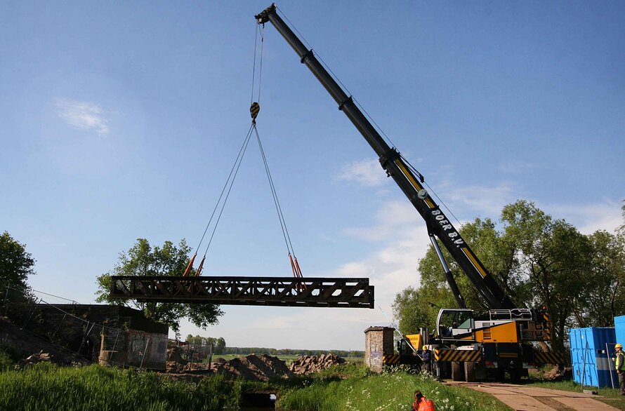
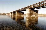
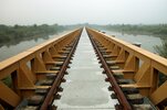
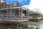
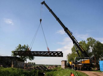
The bridges and the park area are part of the former railway track of the so-called 'Halvezolenlijn'. They are now used as a local pedestrian route, a regional cycling route and partly as a city park. The natural surroundings of the railway track, the nature reserves and cultural ...
Read more
Project details
| Title: | The railway bridges in the Langstraat |
|---|---|
| Entr. year: | 2013 |
| Result: | Award |
| Country: | Netherlands |
| Town: | Langstraat |
| Category type: | building conservation areas and urban design |
| Notes: | -Project full title "A new future for the railway bridges in the Langstraat" -Sites designations: Five historical railway bridges of the former railway between Geertruidenberg and 's-Hertogenbosch in the Netherlands o Bridge Moerputten o Bridge Venkant o Bridge Drunen o Bridge Overstortweg o Bridge Waalwijk - A new park on a part of the former track of the railway for pedestrians and cyclists in the centre of the city of Waalwijk (Floris-V-laan, Noorderparallelweg, Ambrosiuslaan, Spoorbrugweg –Waalwijk). - Two natural and historical landscapes along the former railway Geertruidenberg - ‘s-Hertogenbosch. GPS Co-ordinates: Bridge Moerputten 's-Hertogenbosch 51°41'14,33" N, 5°14'55,13" E; Nature reserve Moerputten 51°41'14,33" N, 5°14'55,13" E; Bridge Venkant Vlijmen 51°41'25,16" N, 5°13'34,44" E; Bridge Drunen 51°41'27,47"N, 5°06'46,46" E; Bridge Overstorteg 51°41'26,17" N, 5°06'36,88" E Bridge Waalwijk 51°41'21.90" N, 5°06'07,38" E Halvezolenpark Waalwijk 51°41'02,50"N, 5°03'44,64" E Cycle track Waalwijk - Raamsdonk 51°40'52,11" N, 5°02'35,34" E; Slagen Landscape Langstraat 51°41'04,21" N, 5°01'29,72" E The bridges and the areas above are indicated by only one co-ordinate, which is the centre of the bridge or the area by approximation. |
| Building type/ Project type: | industrial heritage |
| Former use: | Bridge |
| Actual use: | Local pedestrian route, regional cycling route, city park |
| Built: | 19th century |
| Architect / Proj.leader: | City of 's-Hertogenbosch; Staatsbosbeheer; City of Heusden; Aannemingsbedrijf Nico de Bont; Verlaan en Bouwstra, architekten; City of Waalwijk |
| The Jury's citation: | “The Jury greatly appreciated the many aspects of this project as a combination of private and public initiatives in the fields of planning, infrastructure, nature conservation and heritage. The most eye catching part of the track is ‘the Moerputten’. Overall, not only have five historic bridges been conserved and put into excellent (but reversible) new uses – paths for both cyclists and pedestrians, offering an overview of the symbiosis of landscape, bridge and nature reserve - but also a strong and sustainable contribution has been made to the living environment of both people and nature.” |
| GPS: | various, see Notes |
| Web, Links: | www.langstraatspoorbruggen.nl/Langstraatspoorbruggen/Europa_Nostra_Award_%28ENG%29.html |
Description:
The bridges and the park area are part of the former railway track of the so-called 'Halvezolenlijn'. They are now used as a local pedestrian route, a regional cycling route and partly as a city park. The natural surroundings of the railway track, the nature reserves and cultural historical landscapes of the so-called 'slagen' landscape and the Moerputten, are nowadays open for hikers, bird watchers and other visitors. An interesting combination has been made of cultural historical values, natural values, recreation and local and regional slow traffic.
Similar projects
17th century
12th-13th century
13th century
1925-30
20th century
18th-19th century
19th century
1928-1931

16th century
16th century
